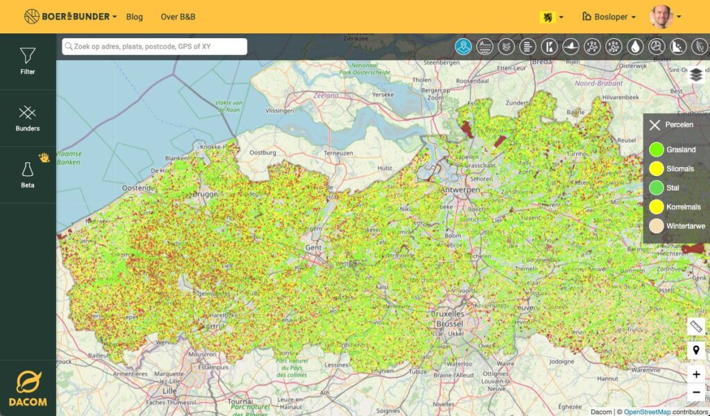
Never before have field data been so clear. With Farmlayer you find information about more than 16,000,000 fields in Europe. We are therefore one of the best-known websites for farmers, contractors, agribusiness and estate agents.
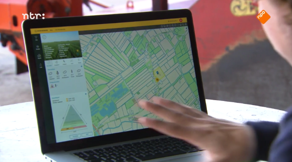
Start with precision farming, with insight into altitude maps and satellite images
Always know the exact cultivable area of fields for planning and invoicing
View crop rotations for creating a healthy cultivation plan
Find and quickly navigate to fields
Find suitable land for renting or purchasing
Create and share your own field lists
Farmlayer Free
€0month
Boer&Bunder countries: -
Number of devices:
Cultivation years: last year
Satellite images: last image
Field report -
Features at national level: -
Search filter: last year’s crop
Dashboard with charts: -
Farmlayer Beta: -
Farmlayer Pro
€21month
Boer&Bunder countries: 1
Number of devices: 2
Cultivation years: recent year
Satellietbeelden: laatst beschikbare
Field report PDF/Shapefile
Features at national level: all available
Search filter: all
Boer&Bunder Beta: yes
Farmlayer Premium
€42,50month
Boer&Bunder countries: all
Dacom Accounts: max 5
Number of devices: 2
Cultivation years: all available
Satellite images: all available
Field report PDF/Shapefile
Features at national level: all available
Search filter: all + export 2,500 fields
Boer&Bunder Beta: yes
Farmer & Acre Lease: yes (only in NL)
Discover all possibilities
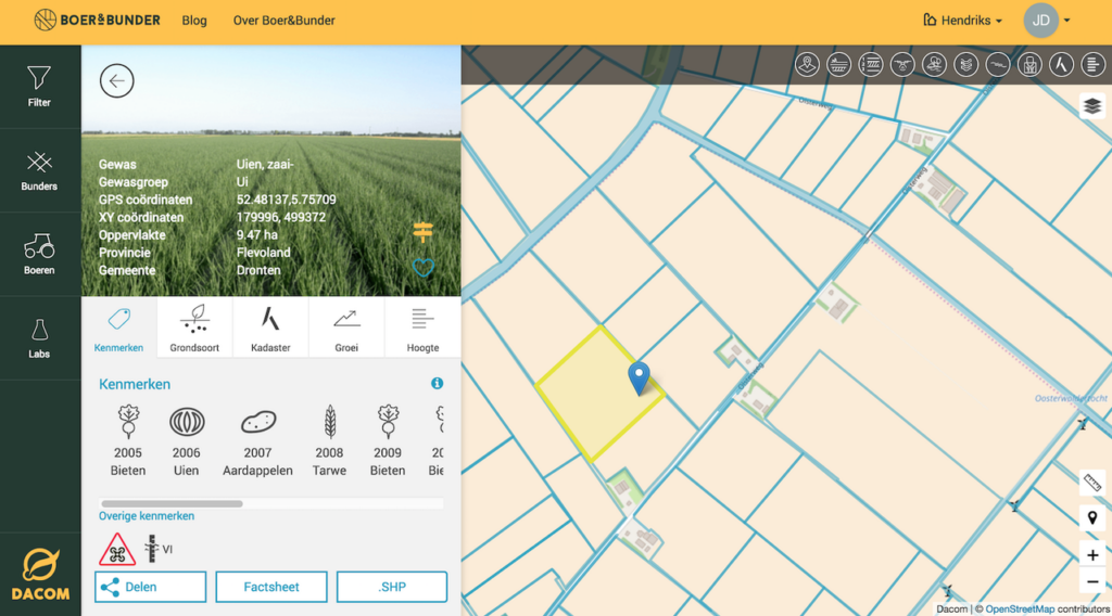
All features of a field in one place
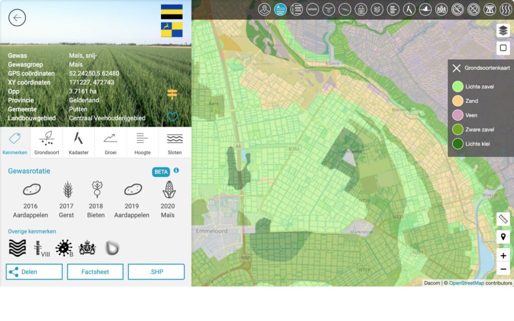
With Boer&Bunder you will find the features of all fields. For example, you will always know the exact cultivable area for a crop of potatoes and what restrictions are in place in groundwater protection areas.
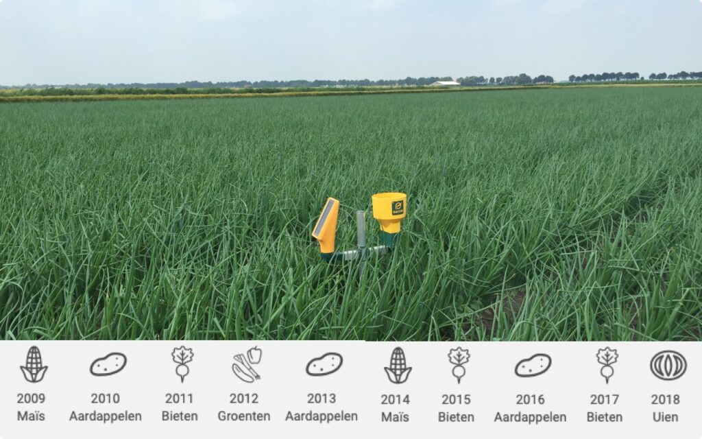
View crop rotations to make cultivation plans
You can find out quickly in Boer&Bunder which crops have grown in fields over the past few years. This is very useful for setting up your cultivation plan or finding suitable land to rent or purchase.
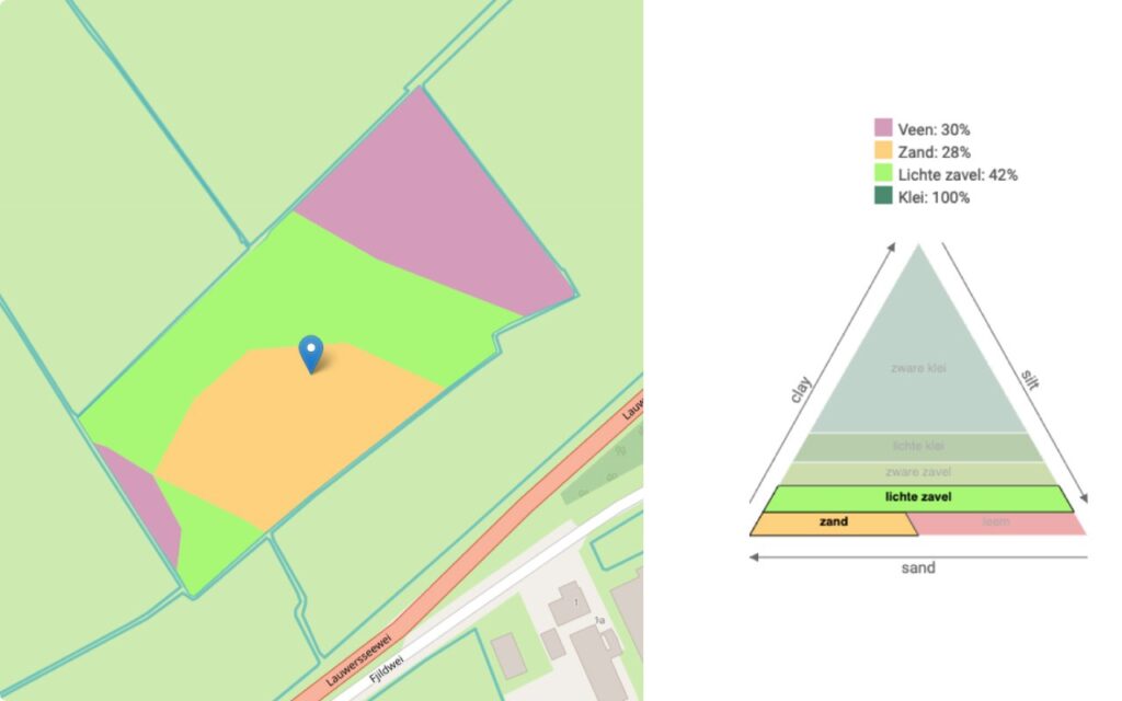
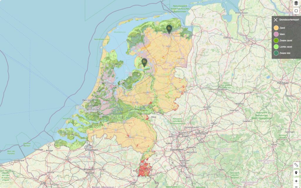
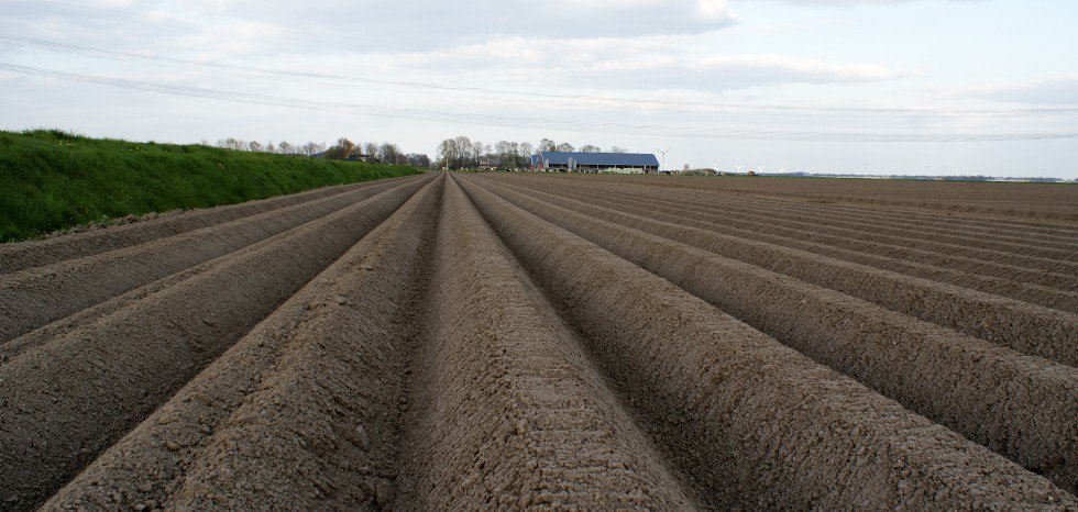
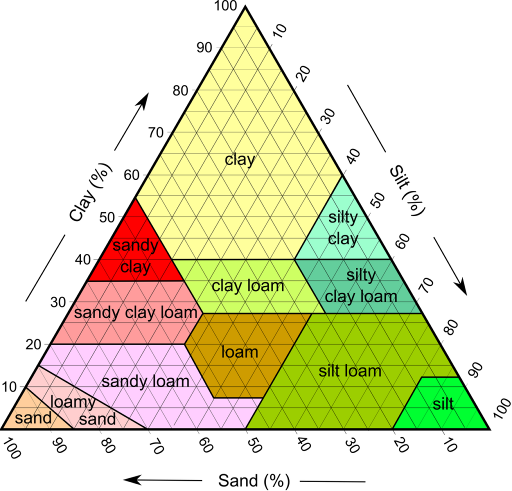
Soil type
View a field’s soil type.
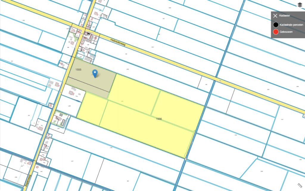
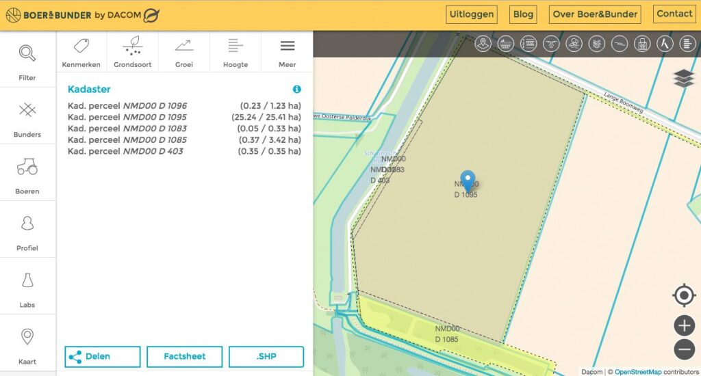
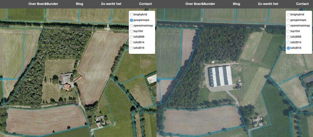
Cadastral ownership
In Boer&Bunder, a single field may consist of different cadastral parcels. We know the underlying cadastral parcels of each field and show the area where they overlap.
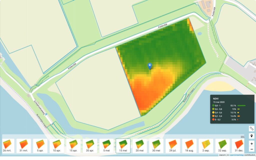
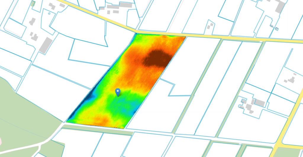
Monitor crop growth
Satellite images show where the crop is growing better or worse. And you can see the growth development over time. A great way to start with precision farming.
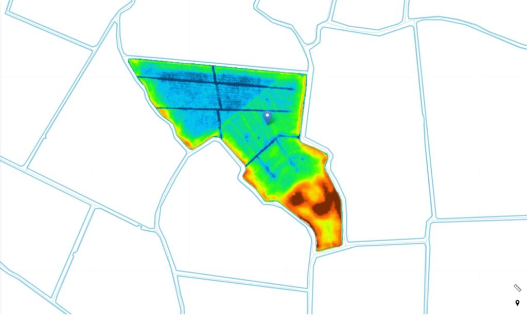
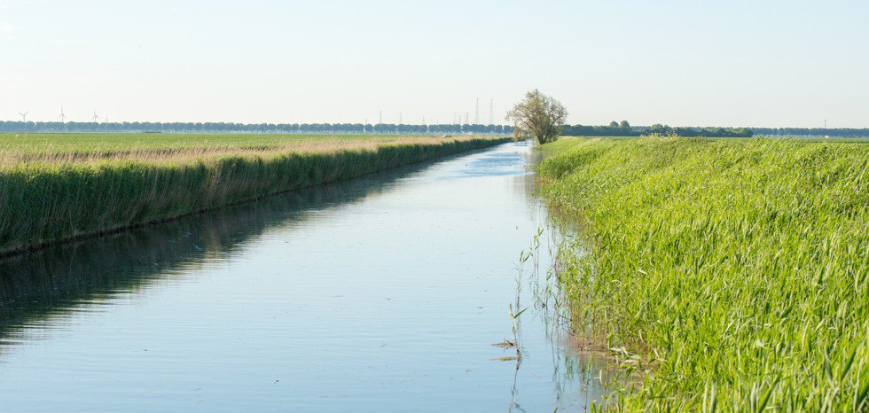
Differences in altitude say a lot about a field
When purchasing or renting land, altitude maps will show whether you should take any measures. They will show, for example, whether and how a field should be graded. The water drainage lines show where you can apply erosion measures.
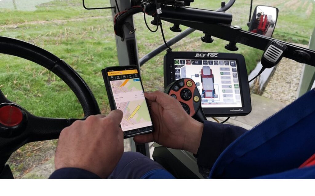
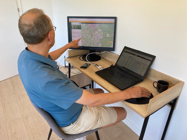
Navigate to fields from your mobile
We have a well-functioning website (not a mobile app), which has been adapted for the small screen of your mobile. This means you can use Boer&Bunder everywhere. Navigate directly to a field by starting your route planner at a field.
Tip: Create a start page via your browser if you want to start Boer&Bunder quickly.
Create and share your own fields
Making your own lists makes it easy to share a group of fields on social media, with your contractor or with staff or your business. In our opinion, this is the perfect feature for anyone who wants to share fields.
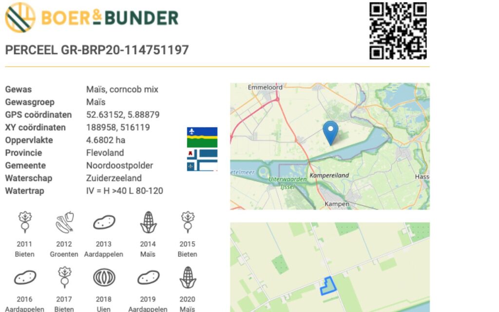
The perfect summary to share or print
A printable field report contains the perfect summary of a field. As it has a unique QR code, you can even mention the field on product packaging if you sell directly to consumers.
View an example of a field report here.
Farming in the picture with national features
In Farmlayer you can switch important field features on and off at national level. Examples of features at national level are crops, soil types, ditches, Natura 2000 and more.
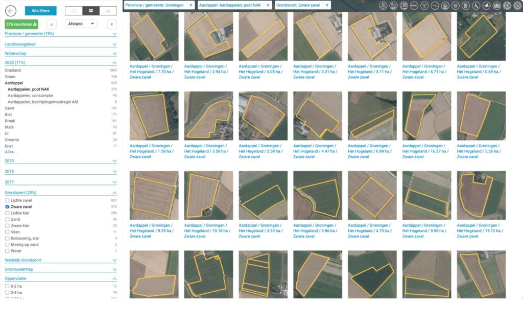
Find suitable land with useful search filters
With our useful search filter you can find on the map precisely those fields an hectares in which you are interested. You can easily export the search results to Excel or a Shapefile. View an example of an export of fields of winter wheat 2017 in the municipality of Emmen here.
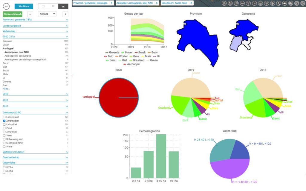
Create your own farming statistics
You can use a dashboard with detailed charts to make analyses of the aerial development of crops. For example, you can see quickly in which soil types a specific crop is grown and what the most important previous crops were.
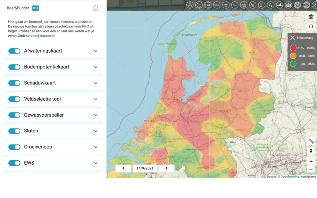
Beta features
In Boer&Bunder Bèta you will find the very latest features of Boer&Bunder, such as a warning system for fungal diseases, the soil potential map, a crop forecaster and much more. Everyone with a PRO version or higher can try them out freely.