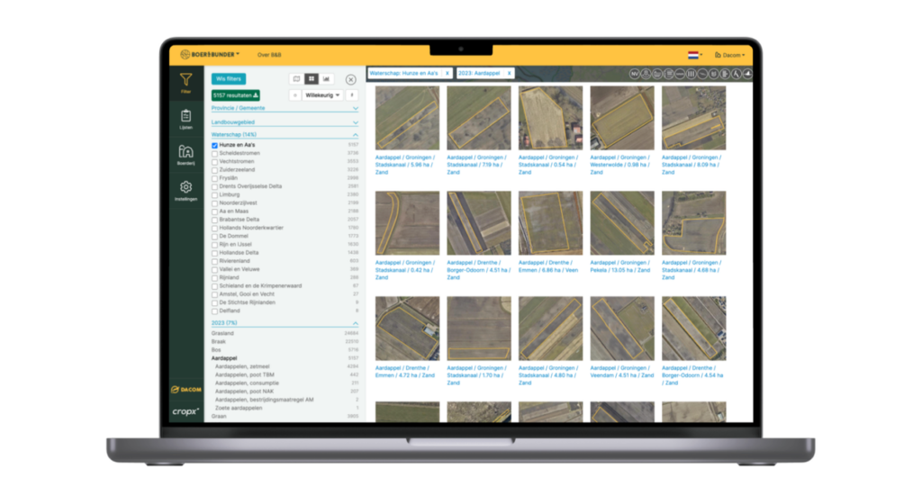
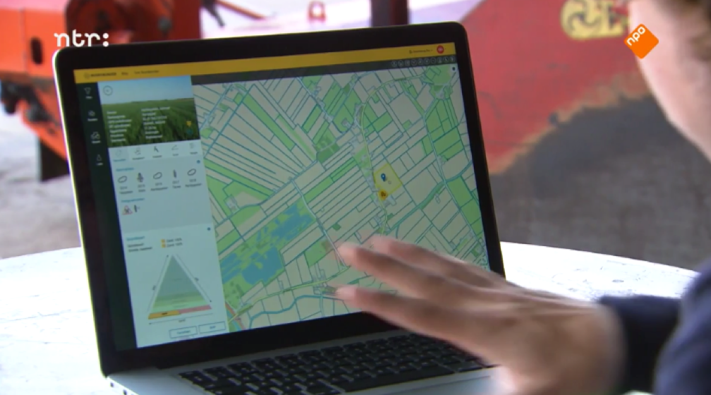
Unleash the full potential of your analyses with Farmlayer Data. With information on over 16,000,000 plots throughout Europe, Farmlayer provides both extensive datasets and specific information on areas, crops, and more. Farmlayer Data easily delivers this data in a .csv file, allowing you to seamlessly integrate it into your own system for thorough analysis. Dive into the power of data for accurate insights and informed decision-making.
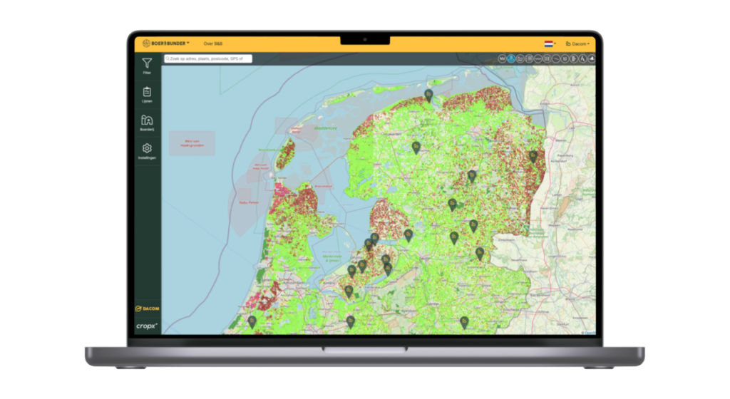
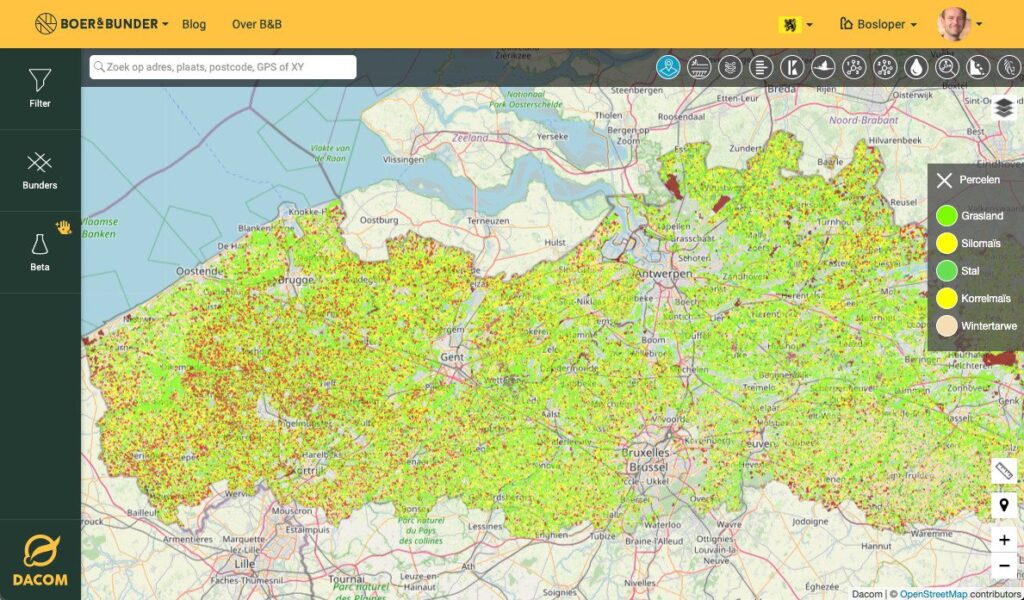
With access to over 16,000,000 fields in Europe, you can conduct analyses at both macro and micro levels, providing insight into broad trends or specific areas, crops, and characteristics.
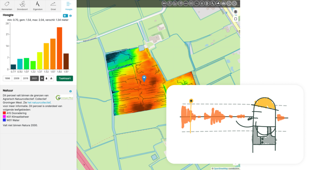
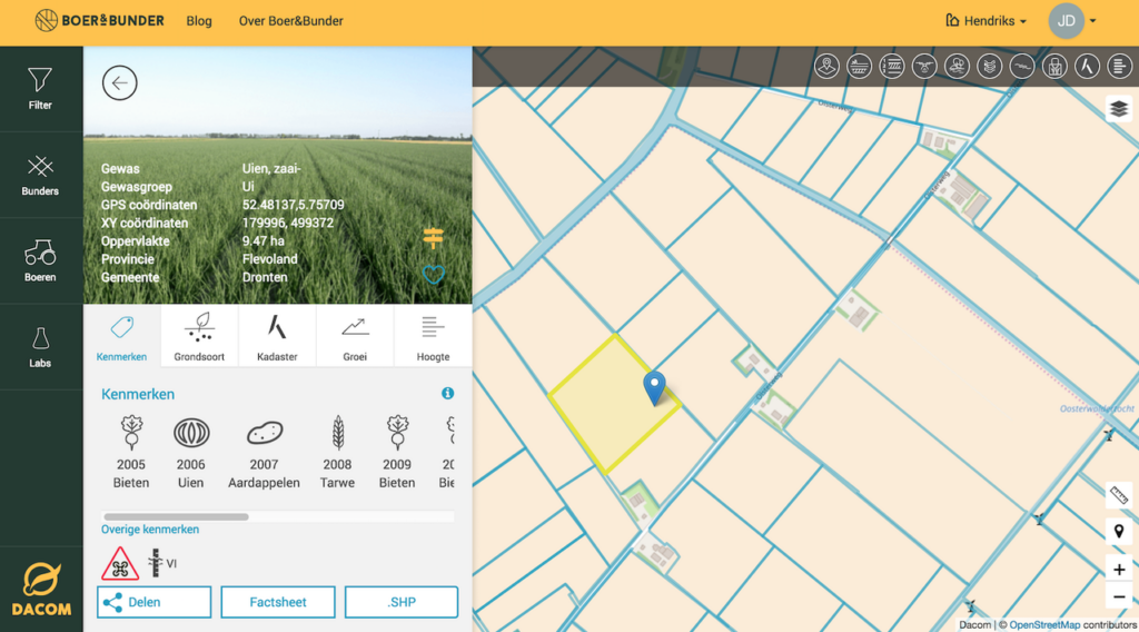
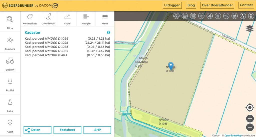
Complete field information
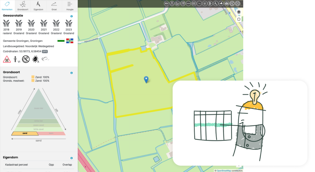
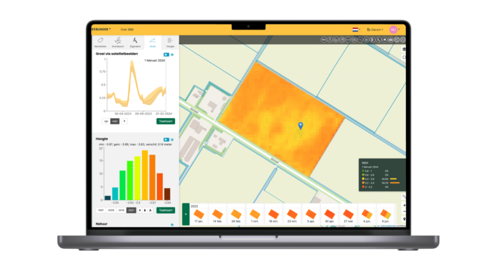
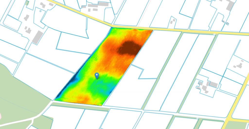
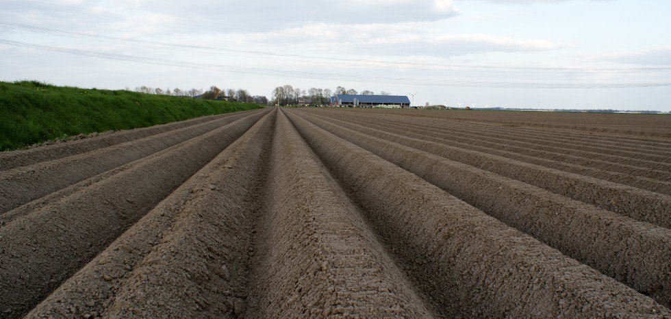
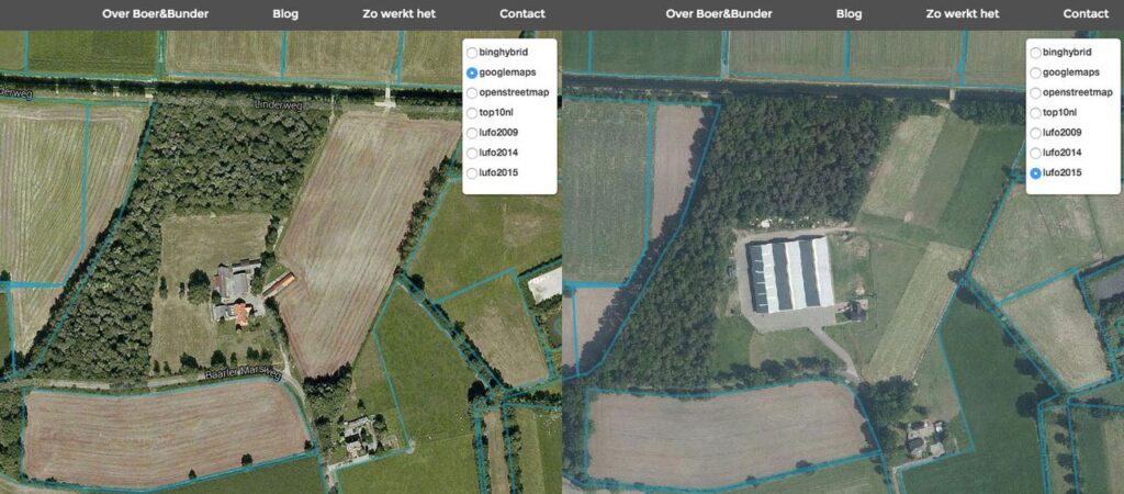
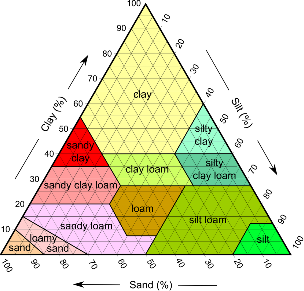
Farmlayer provides comprehensive data, including area, crop rotation, location, elevation map, soil type, and satellite images, allowing you to export and obtain a comprehensive view of individual fields.
Optimization of Agricultural Practices
The export capabilities of Farmlayer enable growers to make better-informed decisions based on specific characteristics such as soil type and crop rotation, which can lead to improved agricultural practices and yields.
Innovative Decision Making
Farmlayer Data exports provide growers, researchers, and professionals in the agricultural sector with the necessary tools for innovative and data-driven decision-making, which can lead to improved productivity and sustainability.
Visual Support with Satellite Imagery
Satellite images provide visual context and support analysis, allowing you to observe the current state of the plots and track any changes over time.
Efficient Land Use Management
With the variety of available data, users can optimize land use, assess the suitability of fields, and develop strategies for sustainable land management.